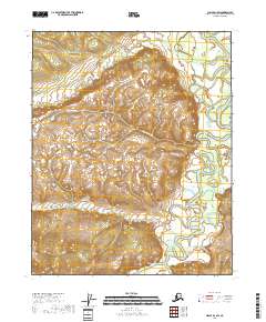
2018 Map of Circle D-1 SW
USGS Topo · Published 2018About this map
Birch Creek dominates the eastern and southern margins of this interior Alaskan landscape, its meandering channel defining the low-lying drainage patterns of the Yukon-Koyukuk region. In this 2018 survey, the terrain is characterized by permafrost-influenced hydrology, most notably the winding path of Thermokarst Cr which cuts through the central sections. The map reveals the intricate network of minor tributaries, including Big Cr in the north and Bluff Cr to the southwest, that feed into the larger creek system. Surveyed by the U.S. Geological Survey, the area is divided into formal townships including t12n r16e, t12n r17e, and t11n r16e, providing a precise look at this subarctic wilderness before further environmental shifts alter the course of these seasonal waterways.
Find a feature on this map
8 named features on this map. Tap any name to fly to it.
Don’t see what you’re looking for? This feature index may not catch every label — zoom into the map to look around manually.
Map Details
Editions of this 2018 Circle D-1 SW Map
This is the sole edition of this map. No revisions or reprints were ever made.
Other maps of this area

1951 · Circle
USGS Topo · 1:250,000

1952 · Circle D-2
USGS Topo · 1:63,360

1955 · Circle C-2
USGS Topo · 1:63,360

1955 · Circle D-1
USGS Topo · 1:63,360

1955 · Circle C-1
USGS Topo · 1:63,360

1955 · Circle
USGS Topo · 1:250,000

1964 · Circle
USGS Topo · 1:250,000
2018 · Circle D-2 NE
USGS Topo · 1:25,000
2018 · Circle C-1 NW
USGS Topo · 1:25,000
2018 · Circle C-1 NE
USGS Topo · 1:25,000