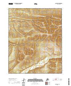
2018 Map of Circle D-5 SE
USGS Topo · Published 2018About this map
The West Crazy Mountains dominate this high-latitude terrain, where steep-sided ridges overlook a complex drainage network. In the southern portion of the quadrangle, the N Fork Preacher Cr and its associated Fork Preacher Cr meander through a broad, low-lying basin characterized by extensive wetlands. This 2018 survey reveals a landscape largely defined by natural watercourses and the stark topography of the interior, showing no permanent human infrastructure or settlements. The drainage pattern of the Preacher Creek forks illustrates the slow migration of water through the alluvial flats beneath the towering mountain summits that occupy the northern half of the sheet.
Find a feature on this map
7 named features on this map. Tap any name to fly to it.
Don’t see what you’re looking for? This feature index may not catch every label — zoom into the map to look around manually.
Map Details
Editions of this 2018 Circle D-5 SE Map
This is the sole edition of this map. No revisions or reprints were ever made.
Other maps of this area

1951 · Circle
USGS Topo · 1:250,000

1952 · Circle D-4
USGS Topo · 1:63,360

1952 · Circle C-4
USGS Topo · 1:63,360

1952 · Circle D-5
USGS Topo · 1:63,360

1952 · Circle C-5
USGS Topo · 1:63,360

1954 · Circle C-5
USGS Topo · 1:63,360

1954 · Circle D-5
USGS Topo · 1:63,360

1955 · Circle
USGS Topo · 1:250,000

1964 · Circle
USGS Topo · 1:250,000
2018 · Circle D-4 NW
USGS Topo · 1:25,000