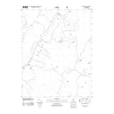
2011 Map of Circleville
USGS Topo · Published 2011About this map
The North Fork South Branch Potomac River carves a central path through this section of Pendleton County, dictated by the massive geological formations of the River Knobs and Castle Mountain. This 2011 survey reveals a landscape where small settlements like Circleville, Riverton, Simoda, and Monkeytown cling to the river valley and gaps in the surrounding ridges. These communities are linked by a network of rural routes, including Bland Hills Rd and Arlie Simmons Rd, which follow the contours of the high terrain.
Find a feature on this map
69 named features on this map. Tap any name to fly to it.
Don’t see what you’re looking for? This feature index may not catch every label — zoom into the map to look around manually.
Map Details
Editions of this 2011 Circleville Map
This is the sole edition of this map. No revisions or reprints were ever made.
Other maps of this area

1889 · Beverly
USGS Topo · 1:125,000

1892 · Beverly
USGS Topo · 1:125,000

1892 · Franklin
USGS Topo · 1:125,000

1896 · Franklin
USGS Topo · 1:125,000

1920 · Onego
USGS Topo · 1:62,500

1921 · Onego
USGS Topo · 1:48,000

1922 · Onego
USGS Topo · 1:62,500

1922 · Horton
USGS Topo · 1:48,000

1922 · Spruce Knob
USGS Topo · 1:48,000

1922 · Circleville
USGS Topo · 1:62,500