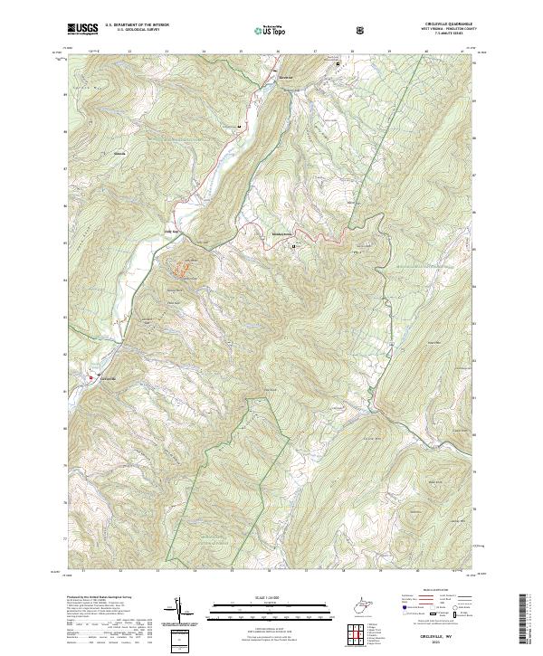
2023 Map of Circleville
USGS Topo · Published 2023About this map
The North Fork South Branch Potomac River carves a deep valley through this corner of Pendleton County, establishing a lifeline for small settlements and family farms. Along its banks, the villages of Circleville, Judy Gap, and Riverton serve as the primary hubs of activity, while smaller hamlets like Simoda and Monkeytown are tucked into the narrow gaps of the River Knobs. The terrain is dominated by the massive ridge of North Fork Mountain, which separates the river corridor from the agricultural expanse of Germany Valley to the east. Local history is preserved in small family and community plots such as Simmons Cem and Burns Cem, while the Old Firetower on Castle Mtn stands as a reminder of early forest management within the Monongahela National Forest.
Find a feature on this map
74 named features on this map. Tap any name to fly to it.
Don’t see what you’re looking for? This feature index may not catch every label — zoom into the map to look around manually.
Map Details
Editions of this 2023 Circleville Map
This is the sole edition of this map. No revisions or reprints were ever made.
Other maps of this area

1889 · Beverly
USGS Topo · 1:125,000

1892 · Beverly
USGS Topo · 1:125,000

1892 · Franklin
USGS Topo · 1:125,000

1896 · Franklin
USGS Topo · 1:125,000

1920 · Onego
USGS Topo · 1:62,500

1921 · Onego
USGS Topo · 1:48,000

1922 · Onego
USGS Topo · 1:62,500

1922 · Horton
USGS Topo · 1:48,000

1922 · Spruce Knob
USGS Topo · 1:48,000

1922 · Circleville
USGS Topo · 1:62,500