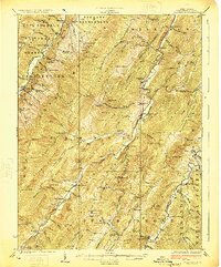
1924 Map of Circleville
USGS Topo · Published 1924About this map
The Germany Settlement and the small hamlets of the Potomac river valleys define this 1924 study of Pendleton County. Settled amidst high ridges like North Fork Mountain and Spruce Mtn, these communities relied on a network of mountain passes and localized industry, evidenced by Harpen Mill and McCoys Mill. The density of small schoolhouses, such as Briery Gap School, Pitzenbarger School, and Painter School, reveals a landscape of isolated but established rural life before modern consolidation. Along the North Fork Potomac River and the South Branch Potomac River, family names are preserved through landmarks like Judy Rocks and Hammon Rocks. This survey captures the transition of the region as the Monongahela National Forest and Shenandoah National Forest began to enclose these traditional upland settlements.
Find a feature on this map
120 named features on this map. Tap any name to fly to it.
Don’t see what you’re looking for? This feature index may not catch every label — zoom into the map to look around manually.
Map Details
Editions of this 1924 Circleville Map
4 editions found

Other maps of this area

1889 · Beverly
USGS Topo · 1:125,000

1892 · Beverly
USGS Topo · 1:125,000

1892 · Franklin
USGS Topo · 1:125,000

1894 · Staunton
USGS Topo · 1:125,000

1896 · Franklin
USGS Topo · 1:125,000

1901 · Monterey
USGS Topo · 1:125,000

1920 · Petersburg
USGS Topo · 1:48,000

1920 · Onego
USGS Topo · 1:62,500

1921 · Petersburg
USGS Topo · 1:48,000

1921 · Onego
USGS Topo · 1:48,000