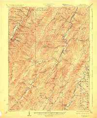
1924 Map of Circleville
USGS Topo · Published 1924About this map
Germany Settlement and the high ridges of the Allegheny Mountains define this 1920s topography of Pendleton County. The landscape is a network of steep mountain gaps and narrow river valleys, anchored by the North Fork Potomac River and the South Branch Potomac River. Small mountain communities such as Circleville, Riverton, and Sugar Grove are documented alongside numerous one-room schoolhouses like Sinnet School and Buffalo School, reflecting the era's rural social structure.
Find a feature on this map
141 named features on this map. Tap any name to fly to it.
Don’t see what you’re looking for? This feature index may not catch every label — zoom into the map to look around manually.
Map Details
Editions of this 1924 Circleville Map
4 editions found

Other maps of this area

1889 · Beverly
USGS Topo · 1:125,000

1892 · Beverly
USGS Topo · 1:125,000

1892 · Franklin
USGS Topo · 1:125,000

1894 · Staunton
USGS Topo · 1:125,000

1896 · Franklin
USGS Topo · 1:125,000

1901 · Monterey
USGS Topo · 1:125,000

1920 · Petersburg
USGS Topo · 1:48,000

1920 · Onego
USGS Topo · 1:62,500

1921 · Petersburg
USGS Topo · 1:48,000

1921 · Onego
USGS Topo · 1:48,000