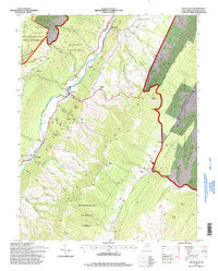
1995 Map of Circleville
USGS Topo · Published 1998About this map
Potomac River South Branch carves a central valley through this rugged section of the Monongahela National Forest, defining the settlement patterns and transport corridors of the late 20th century. Small communities like Circleville, Riverton, and Judy Gap are situated along the valley floor, connected by roads that shadow the river and its many tributaries, including Judy Run and Nelson Run. The map illustrates a landscape of dramatic elevation changes, characterized by the towering North Fork Mountain and the distinct geology of Germany Valley.
Find a feature on this map
53 named features on this map. Tap any name to fly to it.
Don’t see what you’re looking for? This feature index may not catch every label — zoom into the map to look around manually.
Map Details
Editions of this 1995 Circleville Map
This is the sole edition of this map. No revisions or reprints were ever made.
Other maps of this area

1889 · Beverly
USGS Topo · 1:125,000

1892 · Beverly
USGS Topo · 1:125,000

1892 · Franklin
USGS Topo · 1:125,000

1896 · Franklin
USGS Topo · 1:125,000

1920 · Onego
USGS Topo · 1:62,500

1921 · Onego
USGS Topo · 1:48,000

1922 · Onego
USGS Topo · 1:62,500

1922 · Horton
USGS Topo · 1:48,000

1922 · Spruce Knob
USGS Topo · 1:48,000

1922 · Circleville
USGS Topo · 1:62,500