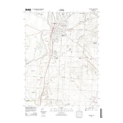
2013 Map of Circleville
USGS Topo · Published 2013About this map
The Scioto River valley dominates this landscape, where the city of Circleville serves as a regional hub for commerce and education. On the northern edge of town, Ohio Christian Univ stands near several residential developments like Knollwood Village and Campus Court. The area's deep history is visible in landmarks such as the Burning Indian Mound and the broad Pickaway Plains, which stretch toward the Pickaway County Memorial Airport. Along the western reaches, Big Darby Creek joins the river system near the settlement of Westfall. Numerous family and community burial grounds, including Saint Joseph Cem, Forest Cem, and the Emmitt Chapel Cem, provide a dense record for genealogical research across the rural landscape. In the south, the terrain transitions toward Black Mtn and the small community of Elmwood, while Hargus Lake offers a significant water feature to the northeast.
Find a feature on this map
115 named features on this map. Tap any name to fly to it.
Don’t see what you’re looking for? This feature index may not catch every label — zoom into the map to look around manually.
Map Details
Editions of this 2013 Circleville Map
This is the sole edition of this map. No revisions or reprints were ever made.
Other maps of this area

1906 · Chillicothe
USGS Topo · 1:62,500

1908 · Chillicothe
USGS Topo · 1:62,500

1911 · Era
USGS Topo · 1:62,500

1912 · Roxabell
USGS Topo · 1:62,500

1913 · Era
USGS Topo · 1:62,500

1914 · Roxabell
USGS Topo · 1:62,500

1914 · Circleville
USGS Topo · 1:62,500

1943 · Era
USGS Topo · 1:62,500

1943 · Circleville
USGS Topo · 1:62,500

1944 · Roxabell
USGS Topo · 1:62,500