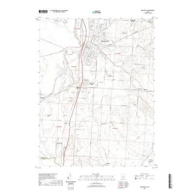
2019 Map of Circleville
USGS Topo · Published 2019About this map
Circleville sits as a regional anchor on the eastern bank of the Scioto River, where the historic Pickaway County Courthouse marks the center of a well-defined grid. The landscape to the south and west transitions into the Pickaway Plains, a flat expanse punctuated by the Scippo Cr and the singular rise of Black Mtn. This modern survey reveals a dense concentration of small family and community burial sites, such as Shortridge Farm Cem, Rife Farm Cem, and Shelby Farm Cem, which offer significant value for genealogical research. The map also documents institutional and residential growth beyond the city core, including Ohio Christian University and developments like Jefferson Estates. A unique cultural landmark, the Burning Indian Mound, remains preserved in the terrain east of Logan Elm Village, illustrating the long-standing human presence in this river valley.
Find a feature on this map
91 named features on this map. Tap any name to fly to it.
Don’t see what you’re looking for? This feature index may not catch every label — zoom into the map to look around manually.
Map Details
Editions of this 2019 Circleville Map
This is the sole edition of this map. No revisions or reprints were ever made.
Other maps of this area

1906 · Chillicothe
USGS Topo · 1:62,500

1908 · Chillicothe
USGS Topo · 1:62,500

1911 · Era
USGS Topo · 1:62,500

1912 · Roxabell
USGS Topo · 1:62,500

1913 · Era
USGS Topo · 1:62,500

1914 · Roxabell
USGS Topo · 1:62,500

1914 · Circleville
USGS Topo · 1:62,500

1943 · Era
USGS Topo · 1:62,500

1943 · Circleville
USGS Topo · 1:62,500

1944 · Roxabell
USGS Topo · 1:62,500