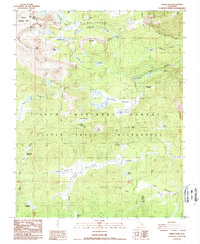
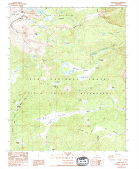
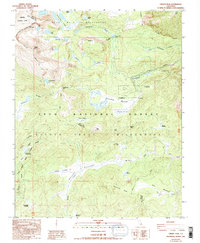
1988 Map of Cirque Peak
USGS Topo · Published 1988About this map
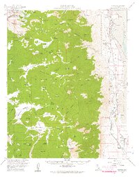
Golden Trout Wilderness and the John Muir Wilderness define this high-elevation landscape in the late 1980s, where the boundary of Sequoia National Park meets Inyo National Forest. The map documents a critical segment of the Pacific Crest National Scenic Trail as it traverses the Sierra Nevada, passing through the Cottonwood Pass and skirting Chicken Spring Lake. This area is a significant hydrological hub, serving as the headwaters for several major drainage systems including Cottonwood Creek and the South Fork Kern River.
Find a feature on this map
43 named features on this map. Tap any name to fly to it.
Don’t see what you’re looking for? This feature index may not catch every label — zoom into the map to look around manually.
Map Details
Editions of this 1988 Cirque Peak Map
3 editions found
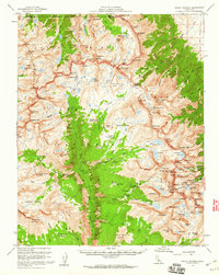
Other maps of this area

1905 · Olancha
USGS Topo · 1:125,000

1907 · Olancha
USGS Topo · 1:125,000

1907 · Mt. Whitney
USGS Topo · 1:125,000

1919 · Mt. Whitney
USGS Topo · 1:125,000

1937 · Mt. Whitney
USGS Topo · 1:125,000

1948 · Fresno
USGS Topo · 1:250,000

1955 · Fresno
USGS Topo · 1:250,000

1956 · Fresno
USGS Topo · 1:250,000
1956 · Mount Whitney
USGS Topo · 1:62,500
1956 · Olancha
USGS Topo · 1:62,500