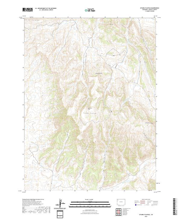
2022 Map of Citadel Plateau
USGS Topo · Published 2022About this map
The Citadel Plateau dominates this portion of the Danforth Hills in Moffat County, where complex drainage systems and high ridges define the high-desert landscape. The area is characterized by deep erosional features like Pine Tree Gulch and Freeman Gulch, which channel seasonal runoff from the surrounding peaks. Distinctive geological markers such as Steamboat Rock and Escarpment Peak provide clear orientation points within this high-elevation terrain. This 2022 survey illustrates the modern road network, primarily composed of routes like Co RD 23 and Co RD 59, which navigate the winding topography. Water sources are scarce but significant, with Bob Hughes Cr and Deep Channel Cr carving paths through the draws, reflecting the critical role of hydrology in shaping the accessibility and land use of these upland pastures and ranges.
Find a feature on this map
23 named features on this map. Tap any name to fly to it.
Don’t see what you’re looking for? This feature index may not catch every label — zoom into the map to look around manually.
Map Details
Editions of this 2022 Citadel Plateau Map
This is the sole edition of this map. No revisions or reprints were ever made.
Other maps of this area

1907 · White River
USGS Topo · 1:125,000

1910 · White River
USGS Topo · 1:125,000

1954 · Vernal
USGS Topo · 1:250,000

1958 · Vernal
USGS Topo · 1:250,000

1958 · Citadel Plateau
USGS Topo · 1:62,500

1960 · Vernal
USGS Topo · 1:250,000

1960 · Elk Springs
USGS Topo · 1:62,500
1966 · White Rock
USGS Topo · 1:24,000
1966 · Smizer Gulch
USGS Topo · 1:24,000
1966 · Indian Valley
USGS Topo · 1:24,000