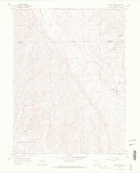
1966 Map of White Rock
USGS Topo · Published 1969About this map
Gray Hills and the prominent Dick Ridge dominate this mid-century landscape in the Colorado high country, bisected by the Moffat Co Rio Blanco Co boundary. The area's water sources reflect its remote character, with specific labels like Moonshine Spring, Bitter Spring, and Coal Spring indicating the vital importance of scattered springs for livestock and travelers. Traces of human activity are sparse but notable, including Storage Bins in the northern reach and a Claypit near the Coyote Basin.
Find a feature on this map
32 named features on this map. Tap any name to fly to it.
Don’t see what you’re looking for? This feature index may not catch every label — zoom into the map to look around manually.
Map Details
Editions of this 1966 White Rock Map
2 editions found
Other maps of this area

1907 · White River
USGS Topo · 1:125,000

1910 · Danforth Hills
USGS Topo · 1:125,000

1910 · White River
USGS Topo · 1:125,000

1912 · Meeker
USGS Topo · 1:62,500

1912 · Axial
USGS Topo · 1:62,500

1914 · Meeker
USGS Topo · 1:62,500

1914 · Axial
USGS Topo · 1:62,500

1954 · Vernal
USGS Topo · 1:250,000

1954 · Craig
USGS Topo · 1:250,000

1957 · Craig
USGS Topo · 1:250,000