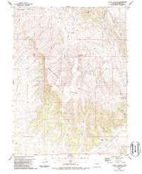
1986 Map of Citadel Plateau
USGS Topo · Published 1986About this map
The high elevation terrain of Moffat County defines this 1986 survey, dominated by the massive Citadel Plateau and the southern reaches of the Danforth Hills. This is a landscape shaped by drainage and topography, where deep gulches like Willow Gulch and Pinto Gulch cut through the plateau towards Deep Channel Creek in the south. Human presence is sparse, centered on the Keystone Ranch and an isolated prospect near the northern heights of Wolf Mountain.
Find a feature on this map
18 named features on this map. Tap any name to fly to it.
Don’t see what you’re looking for? This feature index may not catch every label — zoom into the map to look around manually.
Map Details
Editions of this 1986 Citadel Plateau Map
This is the sole edition of this map. No revisions or reprints were ever made.
Other maps of this area

1907 · White River
USGS Topo · 1:125,000

1910 · White River
USGS Topo · 1:125,000

1954 · Vernal
USGS Topo · 1:250,000

1958 · Vernal
USGS Topo · 1:250,000

1958 · Citadel Plateau
USGS Topo · 1:62,500

1960 · Vernal
USGS Topo · 1:250,000

1960 · Elk Springs
USGS Topo · 1:62,500
1966 · White Rock
USGS Topo · 1:24,000
1966 · Smizer Gulch
USGS Topo · 1:24,000
1966 · Indian Valley
USGS Topo · 1:24,000