
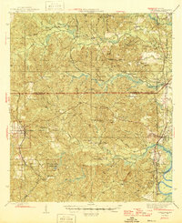
1946 Map of Citronelle
USGS Topo · Published 1946About this map
Citronelle serves as the primary hub in this mid-1940s landscape, positioned along the Gulf Mobile and Ohio Railroad and near the health-focused Cherokee Mineral Sprs. The surrounding territory is defined by its deep community roots, evidenced by the high density of rural institutions such as the Methodist Mission Sch and the Weaver Community House. Moving east toward the Chastang River, the topography descends through ridges like Hurricane Ridge into the wetlands of Poll Bayou.
Find a feature on this map
71 named features on this map. Tap any name to fly to it.
Don’t see what you’re looking for? This feature index may not catch every label — zoom into the map to look around manually.
Map Details
Editions of this 1946 Citronelle Map
2 editions found
Other maps of this area

1941 · Bay Minette
USGS Topo · 1:62,500

1941 · Creola
USGS Topo · 1:62,500

1942 · Deer Park
USGS Topo · 1:62,500

1942 · Wilmer
USGS Topo · 1:62,500

1943 · Creola
USGS Topo · 1:62,500

1943 · Bay Minette
USGS Topo · 1:62,500

1943 · Deer Park
USGS Topo · 1:62,500

1943 · Choctaw Bluff
USGS Topo · 1:62,500

1943 · Tensaw
USGS Topo · 1:62,500

1943 · Citronelle
USGS Topo · 1:62,500