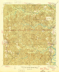
1946 Map of Citronelle
USGS Topo · Published 1946About this map
The Mobile River bottomlands and the timbered hills of southwest Alabama are captured here during the mid-1940s, revealing a landscape defined by its rail connections and remote institutional sites. Citronelle serves as a primary hub on the western edge, noted for the nearby Cherokee Mineral Sprs and the sprawling Cedar Creek State Park. To the east, the Searcy State Hospital stands near the river, while the interior is dotted with legacy settlements like Sims Chapel and Fairford.
Find a feature on this map
70 named features on this map. Tap any name to fly to it.
Don’t see what you’re looking for? This feature index may not catch every label — zoom into the map to look around manually.
Map Details
Editions of this 1946 Citronelle Map
2 editions found

Other maps of this area

1941 · Bay Minette
USGS Topo · 1:62,500

1941 · Creola
USGS Topo · 1:62,500

1942 · Deer Park
USGS Topo · 1:62,500

1942 · Wilmer
USGS Topo · 1:62,500

1943 · Creola
USGS Topo · 1:62,500

1943 · Bay Minette
USGS Topo · 1:62,500

1943 · Deer Park
USGS Topo · 1:62,500

1943 · Choctaw Bluff
USGS Topo · 1:62,500

1943 · Tensaw
USGS Topo · 1:62,500

1943 · Citronelle
USGS Topo · 1:62,500