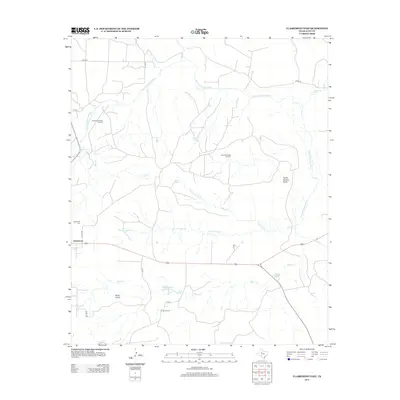
2012 Map of Clairemont East
USGS Topo · Published 2012About this map
Clairemont and its surroundings in Kent County are defined by the winding course of the Salt Fork Brazos River and a network of ephemeral creeks. This early 21st-century landscape reflects the region's historical ties to cattle ranching and petroleum extraction, with the Clairemont North Oil Field and Clairemont East Oil Field marking the upland plains. The legacy of the cattle era is evident in family-named landmarks like the O Bar O Ranch and the Bilby Wallace Ranch Lake.
Find a feature on this map
28 named features on this map. Tap any name to fly to it.
Don’t see what you’re looking for? This feature index may not catch every label — zoom into the map to look around manually.
Map Details
Editions of this 2012 Clairemont East Map
This is the sole edition of this map. No revisions or reprints were ever made.
Other maps of this area

1954 · Lubbock
USGS Topo · 1:250,000

1958 · Jayton
USGS Topo · 1:24,000

1959 · Girard
USGS Topo · 1:24,000

1968 · White Camp
USGS Topo · 1:24,000
1969 · A B C Creek
USGS Topo · 1:24,000

1969 · Cooper Mountain
USGS Topo · 1:24,000

1969 · Clairemont East
USGS Topo · 1:24,000

1969 · Clairemont West
USGS Topo · 1:24,000

1969 · Jayton South
USGS Topo · 1:24,000
1969 · Gant Hills
USGS Topo · 1:24,000