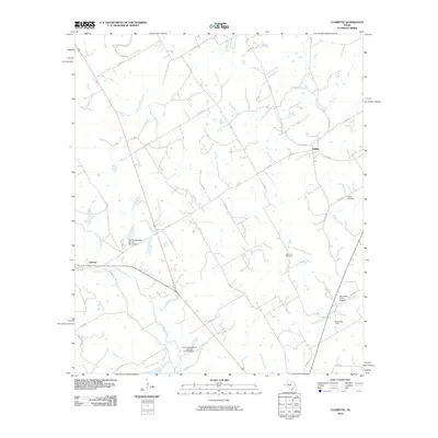
2010 Map of Clairette
USGS Topo · Published 2010About this map
Clairette and Duffau serve as the primary nodes of settlement in this rural Central Texas landscape, where the headwaters of the North Bosque River and Little Duffau Creek carve through the Erath and Hamilton County line. The area’s agricultural character is evident in the presence of small private airstrips like the Ray Smith Farm Airport and McSwain Field, as well as the numerous small stock tanks and flood control structures, such as the Soil Conservation Service Site 24 Dam.
Find a feature on this map
35 named features on this map. Tap any name to fly to it.
Don’t see what you’re looking for? This feature index may not catch every label — zoom into the map to look around manually.
Map Details
Editions of this 2010 Clairette Map
This is the sole edition of this map. No revisions or reprints were ever made.
Other maps of this area

1888 · Hamilton
USGS Topo · 1:125,000

1888 · Meridian
USGS Topo · 1:125,000

1889 · Granbury
USGS Topo · 1:125,000

1890 · Stephenville
USGS Topo · 1:125,000

1894 · Hamilton
USGS Topo · 1:125,000

1894 · Meridian
USGS Topo · 1:125,000

1920 · Stephenville
USGS Topo · 1:125,000

1954 · Brownwood
USGS Topo · 1:250,000

1954 · Dallas
USGS Topo · 1:250,000

1954 · Waco
USGS Topo · 1:250,000