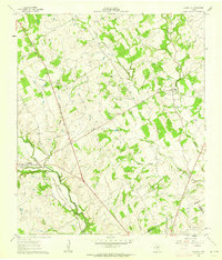
1961 Map of Clairette
USGS Topo · Published 1963About this map
Clairette and Duffau serve as the primary hubs in this early 1960s study of the northern Texas landscape. The region is defined by a dense network of watercourses, including the Bosque River and several namesake streams like Duffau Creek and Little Duffau Creek. Genealogists and local historians will find value in the clear identification of the Duffau Cem and Millerville Cem, which anchor the rural communities of the era. The Missouri-Kansas-Texas railroad line cuts through the western section of the map, illustrating the importance of rail transport for the agricultural and early industrial activity of Erath County. Natural resource extraction is evident through scattered Gas Wells and numerous Borrow Pits, while the presence of Pipelines indicates a landscape transitioning toward mid-century energy infrastructure.
Find a feature on this map
23 named features on this map. Tap any name to fly to it.
Don’t see what you’re looking for? This feature index may not catch every label — zoom into the map to look around manually.
Map Details
Editions of this 1961 Clairette Map
This is the sole edition of this map. No revisions or reprints were ever made.
Other maps of this area

1888 · Hamilton
USGS Topo · 1:125,000

1888 · Meridian
USGS Topo · 1:125,000

1889 · Granbury
USGS Topo · 1:125,000

1890 · Stephenville
USGS Topo · 1:125,000

1894 · Hamilton
USGS Topo · 1:125,000

1894 · Meridian
USGS Topo · 1:125,000

1920 · Stephenville
USGS Topo · 1:125,000

1954 · Brownwood
USGS Topo · 1:250,000

1954 · Dallas
USGS Topo · 1:250,000

1954 · Waco
USGS Topo · 1:250,000