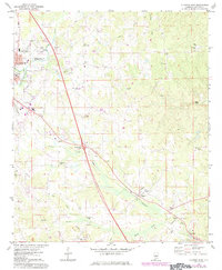
1972 Map of Clanton East
USGS Topo · Published 1984About this map
Clanton serves as the primary hub of this Chilton County landscape during the early 1970s, with development extending southeast toward Verbena and Cooper. The area's social fabric is anchored by numerous rural congregations, including Chestnut Creek Ch and Poplar Springs Ch, alongside educational landmarks like Chilton County High Sch and Adair Sch.
Find a feature on this map
56 named features on this map. Tap any name to fly to it.
Don’t see what you’re looking for? This feature index may not catch every label — zoom into the map to look around manually.
Map Details
Editions of this 1972 Clanton East Map
2 editions found
Other maps of this area

1891 · Clanton
USGS Topo · 1:125,000

1901 · Wetumpka
USGS Topo · 1:125,000

1903 · Wetumpka
USGS Topo · 1:125,000

1953 · Montgomery
USGS Topo · 1:250,000

1956 · Montgomery
USGS Topo · 1:250,000

1957 · Montgomery
USGS Topo · 1:250,000

1959 · Billingsley
USGS Topo · 1:62,500

1959 · Elmore
USGS Topo · 1:62,500
1971 · Mitchell Dam NW
USGS Topo · 1:24,000
1971 · Mitchell Dam
USGS Topo · 1:24,000