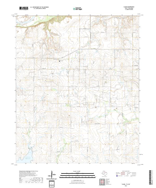
2022 Map of Clara
USGS Topo · Published 2022About this map
The Red River forms the northern boundary of this landscape in Wichita County, where the terrain is defined by a dense network of creek drainages flowing through agricultural lands. The local history of the Clara area is centered around the Clara Cem and several family-named landmarks such as Prairie Cottage Rd and Michna Rd. The map illustrates a rural infrastructure of farm-to-market roads, including FM 1813 and FM 2345, which link the various homesteads and holdings. Water management is a significant feature of the region, anchored by the North Fork Buffalo Creek Reservoir in the southwest corner and Reilly Lake further east. Smaller drainages like Wildhorse Cr, Tenth Cavalry Cr, and Gilbert Cr cut through the plains, shaping the road grid and site locations for historical institutions like the one referenced by Wyeth School Rd.
Find a feature on this map
48 named features on this map. Tap any name to fly to it.
Don’t see what you’re looking for? This feature index may not catch every label — zoom into the map to look around manually.
Map Details
Editions of this 2022 Clara Map
This is the sole edition of this map. No revisions or reprints were ever made.
Other maps of this area

1915 · Clara
USGS Topo · 1:24,000

1915 · Barwise School
USGS Topo · 1:24,000

1915 · Burkburnett
USGS Topo · 1:24,000

1916 · Iowa Park
USGS Topo · 1:24,000

1916 · Fowlkes
USGS Topo · 1:24,000

1918 · Buckburnett
USGS Topo · 1:31,680

1918 · Barwise School
USGS Topo · 1:31,680

1918 · Clara
USGS Topo · 1:31,680

1918 · Iowa Park
USGS Topo · 1:31,680

1919 · Fowlkes
USGS Topo · 1:31,680