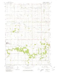
1965 Map of Claremont
USGS Topo · Published 1981About this map
The settlement of Claremont serves as the hub for this mid-1960s agricultural survey, where the Chicago and North Western railway cuts through the heart of the township. This period of Dodge County history is defined by a highly structured drainage and transportation network, evidenced by the presence of Judicial Ditch No 1 and the crossing of the Chicago Great Western railroad to the east near Eden. The landscape is intricately carved by the South Branch Middle Fork Zumbro River and Dodge Center Creek, which dictate the placement of local infrastructure. Genealogists and researchers can find the Claremont Street Cem west of the village, while scattered gravel pits across the terrain indicate the localized extraction industry supporting the region's development during this era of rural expansion.
Find a feature on this map
17 named features on this map. Tap any name to fly to it.
Don’t see what you’re looking for? This feature index may not catch every label — zoom into the map to look around manually.
Map Details
Editions of this 1965 Claremont Map
2 editions found
Other maps of this area

1953 · Saint Paul
USGS Topo · 1:250,000

1954 · Mason City
USGS Topo · 1:250,000

1957 · Mason City
USGS Topo · 1:250,000

1958 · Mason City
USGS Topo · 1:250,000

1959 · Saint Paul
USGS Topo · 1:250,000

1962 · Moland
USGS Topo · 1:24,000

1962 · Owatonna SE
USGS Topo · 1:24,000

1965 · Dodge Center
USGS Topo · 1:24,000

1965 · Concord
USGS Topo · 1:24,000

1965 · Claremont
USGS Topo · 1:24,000