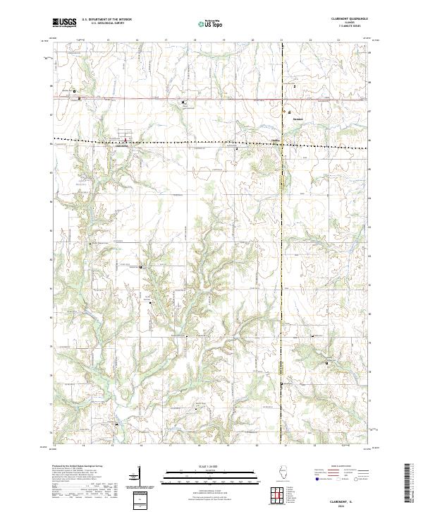
2024 Map of Claremont
USGS Topo · Published 2024About this map
Claremont and Sumner anchor this Illinois landscape, which sits along the border of Richland Co and Lawrence Co. The terrain is defined by a dense network of country roads and small waterways, including the winding paths of Bonpas Creek and Bugaboo Creek. The agricultural character of the region is evident in the numerous family and community burial sites scattered across the township, such as Brinkley Cem, Utterback Cem, and Dutch Flat Cem.
Find a feature on this map
63 named features on this map. Tap any name to fly to it.
Don’t see what you’re looking for? This feature index may not catch every label — zoom into the map to look around manually.
Map Details
Editions of this 2024 Claremont Map
This is the sole edition of this map. No revisions or reprints were ever made.
Other maps of this area

1910 · Hardinville
USGS Topo · 1:62,500

1911 · Sumner
USGS Topo · 1:62,500

1913 · Sumner
USGS Topo · 1:62,500

1941 · Newton
USGS Topo · 1:62,500

1943 · Newton
USGS Topo · 1:62,500

1949 · Olney
USGS Topo · 1:62,500

1956 · Vincennes
USGS Topo · 1:250,000

1957 · Vincennes
USGS Topo · 1:250,000

1958 · Vincennes
USGS Topo · 1:250,000

1958 · Belleville
USGS Topo · 1:250,000