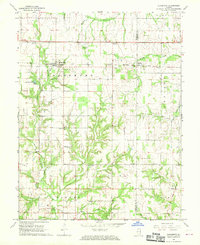
1968 Map of Claremont
USGS Topo · Published 1970About this map
Claremont and the smaller settlement of Hadley serve as central hubs in this landscape, positioned along the busy corridor of the Baltimore and Ohio railroad. The map reveals a highly structured rural society defined by its township boundaries, including Claremont, Petty, Christy, and Lukin, with the Indian Boundary Line cutting a diagonal path through the southeastern corner. This survey is particularly valuable for genealogical research, documenting numerous small family and community burial grounds such as Utterback Cem, Lone Tree Cem, and Wesley Chapel Cem.
Find a feature on this map
40 named features on this map. Tap any name to fly to it.
Don’t see what you’re looking for? This feature index may not catch every label — zoom into the map to look around manually.
Map Details
Editions of this 1968 Claremont Map
This is the sole edition of this map. No revisions or reprints were ever made.
Other maps of this area

1910 · Hardinville
USGS Topo · 1:62,500

1911 · Sumner
USGS Topo · 1:62,500

1913 · Sumner
USGS Topo · 1:62,500

1941 · Newton
USGS Topo · 1:62,500

1943 · Newton
USGS Topo · 1:62,500

1949 · Olney
USGS Topo · 1:62,500

1956 · Vincennes
USGS Topo · 1:250,000

1957 · Vincennes
USGS Topo · 1:250,000

1958 · Vincennes
USGS Topo · 1:250,000

1958 · Belleville
USGS Topo · 1:250,000