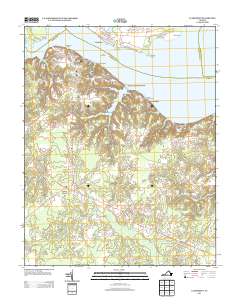
2013 Map of Claremont
USGS Topo · Published 2013About this map
The James River dominates this landscape where Surry County meets the water, illustrating a shoreline defined by historical maritime activity and deep-cut marshes. The settlement of Claremont and the adjacent Claremont Manor sit atop the bluffs, with the Claremont Wharf serving as a tangible connection to the river's navigational history. Across the water, points like Ferry Point and Sandy Point suggest long-standing river crossings that once linked these communities.
Find a feature on this map
35 named features on this map. Tap any name to fly to it.
Don’t see what you’re looking for? This feature index may not catch every label — zoom into the map to look around manually.
Map Details
Editions of this 2013 Claremont Map
This is the sole edition of this map. No revisions or reprints were ever made.
Other maps of this area

1917 · Toano
USGS Topo · 1:62,500

1918 · Charles City
USGS Topo · 1:62,500

1918 · Toano
USGS Topo · 1:62,500

1919 · Surry
USGS Topo · 1:62,500

1919 · Disputanta
USGS Topo · 1:62,500

1943 · Savedge
USGS Topo · 1:31,680

1943 · Richmond
USGS Topo · 1:250,000

1944 · Waverly
USGS Topo · 1:31,680

1949 · Richmond
USGS Topo · 1:250,000
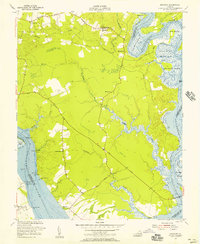
1952 · Brandon
USGS Topo · 1:24,000