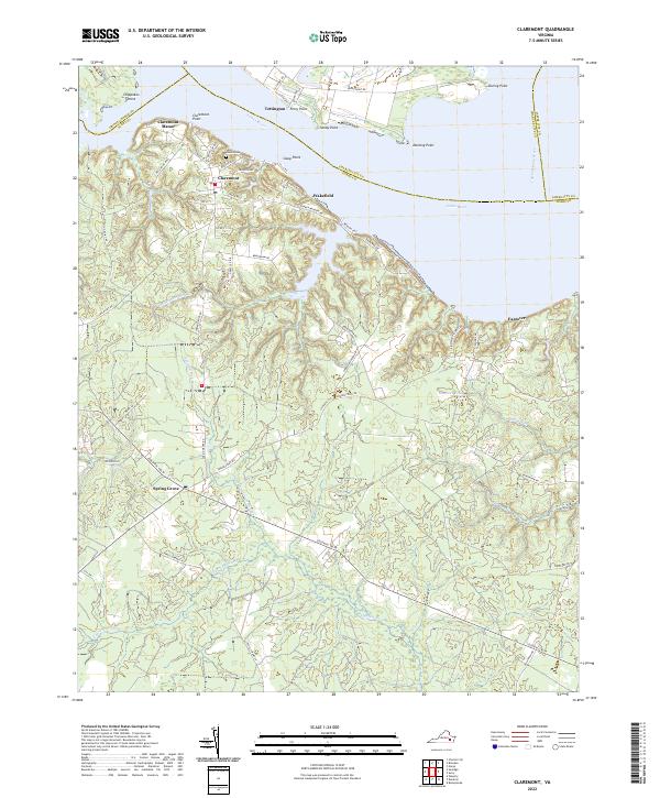
2022 Map of Claremont
USGS Topo · Published 2022About this map
The James River dominates this Tidewater landscape, where the confluence with the Chickahominy River meets a series of prominent landforms including Dancing Point and Claremont Point. The settlement of Claremont sits atop the southern bank, characterized by a traditional street grid with routes like Mansion Ave and Virginia Ave leading toward Claremont Manor. This riverfront orientation defines the local geography, as the land transitions from high bluffs into the dense hydrologic networks of Cypress Swamp and Spring Grove Swamp to the south.
Find a feature on this map
60 named features on this map. Tap any name to fly to it.
Don’t see what you’re looking for? This feature index may not catch every label — zoom into the map to look around manually.
Map Details
Editions of this 2022 Claremont Map
This is the sole edition of this map. No revisions or reprints were ever made.
Other maps of this area

1917 · Toano
USGS Topo · 1:62,500

1918 · Charles City
USGS Topo · 1:62,500

1918 · Toano
USGS Topo · 1:62,500

1919 · Surry
USGS Topo · 1:62,500

1919 · Disputanta
USGS Topo · 1:62,500

1943 · Savedge
USGS Topo · 1:31,680

1943 · Richmond
USGS Topo · 1:250,000

1944 · Waverly
USGS Topo · 1:31,680

1949 · Richmond
USGS Topo · 1:250,000
1952 · Brandon
USGS Topo · 1:24,000