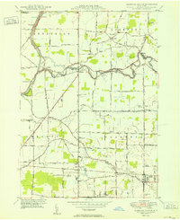
1950 Map of Clarence Center
USGS Topo · Published 1950About this map
Tonawanda Creek meanders across this rural landscape, serving as the natural boundary between Niagara and Erie counties at the midcentury. The settlement of Clarence Center anchors the southeast, while the Erie Canal cuts through the northwest corner, featuring the Sulphur Springs Guard Lock and proximity to Hodgeville Sta. This era captures a transition from traditional agricultural patterns to early suburban features, evidenced by the presence of Steffen Airport and the Transit Valley Golf Course.
Find a feature on this map
86 named features on this map. Tap any name to fly to it.
Don’t see what you’re looking for? This feature index may not catch every label — zoom into the map to look around manually.
Map Details
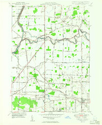
Editions of this 1950 Clarence Center Map
2 editions found
Other maps of this area

1894 · Buffalo
USGS Topo · 1:62,500

1897 · Tonawanda
USGS Topo · 1:62,500

1897 · Lockport
USGS Topo · 1:62,500

1899 · Niagara
USGS Topo · 1:125,000

1900 · Tonawanda
USGS Topo · 1:62,500

1901 · Buffalo
USGS Topo · 1:62,500

1901 · Tonawanda
USGS Topo · 1:62,500

1902 · Lockport
USGS Topo · 1:62,500

1905 · Depew
USGS Topo · 1:62,500

1905 · Lockport
USGS Topo · 1:62,500