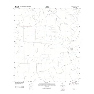
2013 Map of Clareville
USGS Topo · Published 2013About this map
Clareville sits at the heart of this Bee County landscape, where the agricultural grid is defined by a dense network of country roads and ephemeral waterways. The terrain is bisected by the winding courses of Aransas Cr and Elm Cr, which weave through the farm and ranch lands. A notable cultural landmark is the San Pedro Cem, located near Kinkler Ln, providing a focal point for local genealogical interest. The northern portion of the map is dominated by the Beeville Municipal Airport, while the southern reaches extend toward the banks of Olmos Cr. This survey illustrates the persistent rural character of the region, where family-named routes like Amador Ramirez Ln and Gaitan Rd reveal the enduring local heritage and land-use patterns of South Texas.
Find a feature on this map
50 named features on this map. Tap any name to fly to it.
Don’t see what you’re looking for? This feature index may not catch every label — zoom into the map to look around manually.
Map Details
Editions of this 2013 Clareville Map
This is the sole edition of this map. No revisions or reprints were ever made.
Other maps of this area

1925 · Mathis No. 2
USGS Topo · 1:48,000

1927 · Mathis
USGS Topo · 1:62,500

1953 · Beeville
USGS Topo · 1:250,000

1954 · Skidmore
USGS Topo · 1:62,500

1954 · Fleming
USGS Topo · 1:62,500

1954 · Mathis
USGS Topo · 1:62,500

1954 · Sinton
USGS Topo · 1:62,500

1956 · Beeville
USGS Topo · 1:250,000

1960 · Beeville
USGS Topo · 1:250,000
1979 · Tynan
USGS Topo · 1:24,000