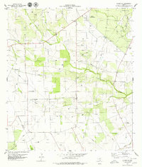
1979 Map of Clareville
USGS Topo · Published 1979About this map
Clareville sits at the western edge of Bee County in the late 1970s, where the landscape is defined by the intersection of South Texas ranching and petroleum interests. The Oil Field patterns suggest an active energy economy, with wells scattered across the terrain between Aransas Creek and Elm Creek. To the north, the Beeville Municipal Airport provides a modern navigational hub, while a local Race Track located near the center of the sheet hints at rural recreation during this period.
Find a feature on this map
17 named features on this map. Tap any name to fly to it.
Don’t see what you’re looking for? This feature index may not catch every label — zoom into the map to look around manually.
Map Details
Editions of this 1979 Clareville Map
This is the sole edition of this map. No revisions or reprints were ever made.
Other maps of this area

1925 · Mathis No. 2
USGS Topo · 1:48,000

1927 · Mathis
USGS Topo · 1:62,500

1953 · Beeville
USGS Topo · 1:250,000

1954 · Skidmore
USGS Topo · 1:62,500

1954 · Fleming
USGS Topo · 1:62,500

1954 · Mathis
USGS Topo · 1:62,500

1954 · Sinton
USGS Topo · 1:62,500

1956 · Beeville
USGS Topo · 1:250,000

1960 · Beeville
USGS Topo · 1:250,000
1979 · Tynan
USGS Topo · 1:24,000