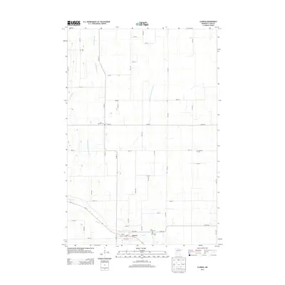
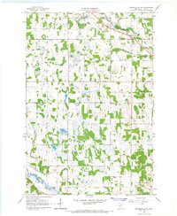
2013 Map of Clarissa
USGS Topo · Published 2013About this map
Clarissa serves as the central hub of this Central Minnesota landscape, situated where the Eagle Cr flows toward the southern edge of the quadrangle. The town's layout is closely tied to its local services, including a central Po and a network of county highways. Outside of the settlement, the terrain is defined by a series of engineered watercourses such as County Ditch Number Twentyfive and County Ditch Number Thirtyone, reflecting a history of land management and drainage for agricultural use. The northern reaches are drained by the meandering Partridge River. For those researching family history in Todd County, the map identifies several distinct burial sites across the township, including Zoar Cem in the northwest, Saint Matthews Cem near the center, and Bethlehem Cem to the east, alongside the Saint Joseph Cem and Woodmans Cem located closer to the main town site.
Find a feature on this map
47 named features on this map. Tap any name to fly to it.
Don’t see what you’re looking for? This feature index may not catch every label — zoom into the map to look around manually.
Map Details
Editions of this 2013 Clarissa Map
This is the sole edition of this map. No revisions or reprints were ever made.
Other maps of this area

1953 · Brainerd
USGS Topo · 1:250,000

1957 · Brainerd
USGS Topo · 1:250,000

1958 · Brainerd
USGS Topo · 1:250,000

1965 · Brainerd
USGS Topo · 1:250,000
1966 · Browerville
USGS Topo · 1:24,000
1966 · Browerville NE
USGS Topo · 1:24,000

1966 · Staples
USGS Topo · 1:24,000
1966 · Clarissa
USGS Topo · 1:24,000
1966 · Browerville SW
USGS Topo · 1:24,000

1966 · Aldrich South
USGS Topo · 1:24,000