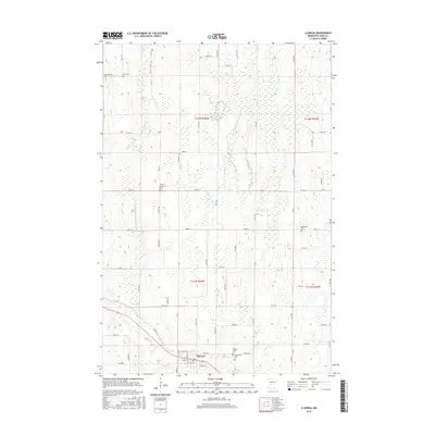
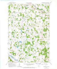
2016 Map of Clarissa
USGS Topo · Published 2016About this map
The settlement of Clarissa serves as the central hub of this Todd County landscape, situated along the banks of Eagle Cr. This region of central Minnesota is defined by a complex network of managed waterways, including County Ditch Number Thirtyone and County Ditch Number Twentyfive, which cut through the terrain to support the area's agricultural needs. The land is notably dotted with numerous small cemeteries, reflecting the generational history of the local communities. To the north, the Scandinavian Cem and Zoar Cem mark the landscape, while Saint Matthews Cem and the Bethlehem Cem are positioned near the township boundaries. Further south, the community presence is anchored by Saint Joseph Cem and Woodmans Cem, providing significant points of interest for those tracing family lineages in this rural township setting.
Find a feature on this map
62 named features on this map. Tap any name to fly to it.
Don’t see what you’re looking for? This feature index may not catch every label — zoom into the map to look around manually.
Map Details
Editions of this 2016 Clarissa Map
This is the sole edition of this map. No revisions or reprints were ever made.
Other maps of this area

1953 · Brainerd
USGS Topo · 1:250,000

1957 · Brainerd
USGS Topo · 1:250,000

1958 · Brainerd
USGS Topo · 1:250,000

1965 · Brainerd
USGS Topo · 1:250,000
1966 · Browerville
USGS Topo · 1:24,000
1966 · Browerville NE
USGS Topo · 1:24,000

1966 · Staples
USGS Topo · 1:24,000
1966 · Clarissa
USGS Topo · 1:24,000
1966 · Browerville SW
USGS Topo · 1:24,000

1966 · Aldrich South
USGS Topo · 1:24,000