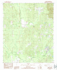
1989 Map of Clark
USGS Topo · Published 1989About this map
Clarks anchor the southeastern corner of this Caldwell Parish landscape, appearing as a concentrated grid of streets during the late 1980s. The surrounding terrain is defined by an intricate network of waterways, with Castor Creek and Black Bayou meandering through the low-lying timberlands and bottomlands. Evidence of the region’s fire management and observation history is found at the Mount Pleasant Lookout Tower, a prominent landmark situated on the higher ground to the north. A Double Wooden Pole Power Line cuts a straight path through the drainage basins of Richland Creek and Hurricane Creek, indicating the infrastructure supporting the local timber and rural economy. Genealogists and local historians will find interest in the isolated Grave located north of Richland Creek, preserved amid the dense network of small tributaries like Piney Creek and Messer Creek.
Find a feature on this map
14 named features on this map. Tap any name to fly to it.
Don’t see what you’re looking for? This feature index may not catch every label — zoom into the map to look around manually.
Map Details
Editions of this 1989 Clark Map
This is the sole edition of this map. No revisions or reprints were ever made.
Other maps of this area

1940 · Columbia
USGS Topo · 1:62,500

1953 · Alexandria
USGS Topo · 1:250,000

1954 · Sikes
USGS Topo · 1:62,500

1954 · Tullos
USGS Topo · 1:62,500

1955 · Shreveport
USGS Topo · 1:250,000

1955 · Alexandria
USGS Topo · 1:250,000

1955 · Olla
USGS Topo · 1:62,500

1956 · Shreveport
USGS Topo · 1:250,000

1957 · Columbia
USGS Topo · 1:62,500

1984 · Shreveport
USGS Topo · 1:250,000