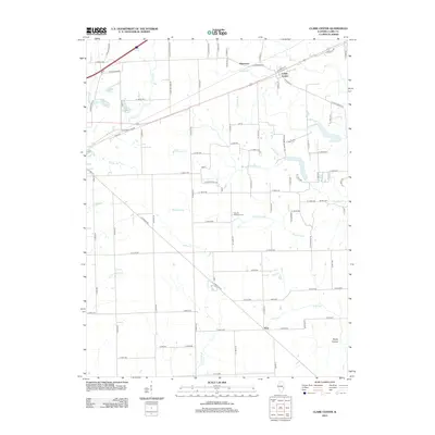
2012 Map of Clark Center
USGS Topo · Published 2012About this map
Clark Center serves as the primary settlement hub in this rural Illinois landscape, situated at the intersection of several local routes such as E Clark Center Rd and Byron St. The surrounding countryside is defined by a dense network of watercourses that drain the agricultural fields, including Hurricane Cr, Willow Cr, and the branching Blackburn Br. Further south, the terrain descends into Rocky Hollow near the flow of Joes Fork.
Find a feature on this map
87 named features on this map. Tap any name to fly to it.
Don’t see what you’re looking for? This feature index may not catch every label — zoom into the map to look around manually.
Map Details
Editions of this 2012 Clark Center Map
This is the sole edition of this map. No revisions or reprints were ever made.
Other maps of this area

1932 · Marshall
USGS Topo · 1:62,500

1936 · Casey
USGS Topo · 1:48,000

1937 · Marshall
USGS Topo · 1:62,500

1942 · Casey
USGS Topo · 1:62,500

1943 · Casey
USGS Topo · 1:62,500

1953 · Indianapolis
USGS Topo · 1:250,000

1956 · Indianapolis
USGS Topo · 1:250,000

1956 · Annapolis
USGS Topo · 1:62,500

1957 · Indianapolis
USGS Topo · 1:250,000

1957 · Hutsonville
USGS Topo · 1:62,500