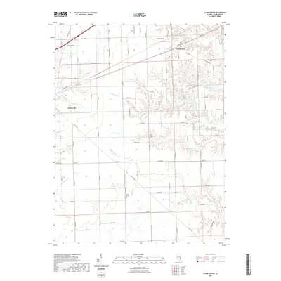
2021 Map of Clark Center
USGS Topo · Published 2021About this map
Martinsville and Clark Center anchor this portion of Clark County, where the landscape transitions from the flat agricultural plains of the north toward the intricate creek systems of the south. The terrain is deeply etched by a network of waterways including Hurricane Cr and its tributaries, creating the distinct relief of Rocky Hollow. This drainage pattern significantly influenced the local road network, which navigates the winding courses of Blackburn Br and Joes Fork.
Find a feature on this map
51 named features on this map. Tap any name to fly to it.
Don’t see what you’re looking for? This feature index may not catch every label — zoom into the map to look around manually.
Map Details
Editions of this 2021 Clark Center Map
This is the sole edition of this map. No revisions or reprints were ever made.
Other maps of this area

1932 · Marshall
USGS Topo · 1:62,500

1936 · Casey
USGS Topo · 1:48,000

1937 · Marshall
USGS Topo · 1:62,500

1942 · Casey
USGS Topo · 1:62,500

1943 · Casey
USGS Topo · 1:62,500

1953 · Indianapolis
USGS Topo · 1:250,000

1956 · Indianapolis
USGS Topo · 1:250,000

1956 · Annapolis
USGS Topo · 1:62,500

1957 · Indianapolis
USGS Topo · 1:250,000

1957 · Hutsonville
USGS Topo · 1:62,500