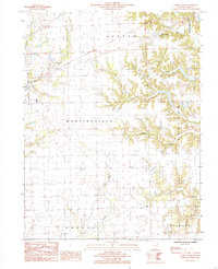
1984 Map of Clark Center
USGS Topo · Published 1985About this map
Clark Center stands as a focal point in this portion of Clark County, situated at the intersection of rural routes during the early 1980s. The landscape is defined by the intricate dendritic drainage patterns of several waterways, including Mill Creek, Hurricane Creek, and the many-fingered Blackburn Branch. These streams carve through the central Illinois plains, creating a distinct contrast between the flat upland agricultural fields and the wooded, sloping ravines that follow the water's edge.
Find a feature on this map
21 named features on this map. Tap any name to fly to it.
Don’t see what you’re looking for? This feature index may not catch every label — zoom into the map to look around manually.
Map Details
Editions of this 1984 Clark Center Map
This is the sole edition of this map. No revisions or reprints were ever made.
Other maps of this area

1932 · Marshall
USGS Topo · 1:62,500

1936 · Casey
USGS Topo · 1:48,000

1937 · Marshall
USGS Topo · 1:62,500

1942 · Casey
USGS Topo · 1:62,500

1943 · Casey
USGS Topo · 1:62,500

1953 · Indianapolis
USGS Topo · 1:250,000

1956 · Indianapolis
USGS Topo · 1:250,000

1956 · Annapolis
USGS Topo · 1:62,500

1957 · Indianapolis
USGS Topo · 1:250,000

1957 · Hutsonville
USGS Topo · 1:62,500