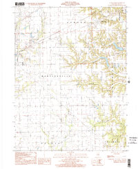
1998 Map of Clark Center
USGS Topo · Published 2002About this map
Clark Center and the surrounding rural townships of Martinsville, Auburn, and Orange characterize this 1990s landscape in Clark County. The area is defined by a dense network of watercourses, including Mill Creek, Hurricane Branch, and Joes Fork, which carve through the terrain as it transitions from agricultural tablelands to more dissected creek beds. The map documents the scattered settlement patterns of the late 20th century, from the small hub at Auburn to the southern locale of Weir. Evidence of early community foundations remains visible through features like a lonely Cem and named geographic markers like Rocky Hol. A pipeline corridors and local road networks link these townships, illustrating the intersection of modern infrastructure with long-established rural boundaries that have defined this portion of eastern Illinois for generations.
Find a feature on this map
22 named features on this map. Tap any name to fly to it.
Don’t see what you’re looking for? This feature index may not catch every label — zoom into the map to look around manually.
Map Details
Editions of this 1998 Clark Center Map
This is the sole edition of this map. No revisions or reprints were ever made.
Other maps of this area

1932 · Marshall
USGS Topo · 1:62,500

1936 · Casey
USGS Topo · 1:48,000

1937 · Marshall
USGS Topo · 1:62,500

1942 · Casey
USGS Topo · 1:62,500

1943 · Casey
USGS Topo · 1:62,500

1953 · Indianapolis
USGS Topo · 1:250,000

1956 · Indianapolis
USGS Topo · 1:250,000

1956 · Annapolis
USGS Topo · 1:62,500

1957 · Indianapolis
USGS Topo · 1:250,000

1957 · Hutsonville
USGS Topo · 1:62,500