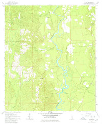
1964 Map of Clark
USGS Topo · Published 1980About this map
The Chickasawhay River meanders through the heart of Greene County, creating a landscape defined by sharp oxbows and swampy bottomlands. In the early 1960s, the rural character of this region is reflected in its scattered settlements and numerous family-named burial grounds. Old Avera and Griffin stand as primary points of orientation, while the settlement at Clark is anchored by the Fellowship Cem. Much of the western territory is protected within the De Soto National Forest, where smaller tributaries like Panther Branch and Waterfork Branch carve through the timberland.
Find a feature on this map
39 named features on this map. Tap any name to fly to it.
Don’t see what you’re looking for? This feature index may not catch every label — zoom into the map to look around manually.
Map Details
Editions of this 1964 Clark Map
3 editions found
Other maps of this area

1942 · Deer Park
USGS Topo · 1:62,500

1943 · Deer Park
USGS Topo · 1:62,500

1953 · Hattiesburg
USGS Topo · 1:250,000

1958 · Hattiesburg
USGS Topo · 1:250,000

1964 · Knobtown
USGS Topo · 1:24,000

1964 · Clark
USGS Topo · 1:24,000

1964 · Avera
USGS Topo · 1:24,000

1964 · Piave
USGS Topo · 1:24,000

1972 · Leakesville
USGS Topo · 1:24,000

1973 · Jonathan
USGS Topo · 1:24,000