
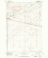
1962 Map of Clarke
USGS Topo · Published 1963About this map
The small settlement of Clarke and the critical Boardman Junction define this high-desert corridor in Morrow County during the early 1960s. The landscape is a study in Cold War era infrastructure, dominated on its eastern and western flanks by the massive federal footprints of the Umatilla Ordnance Depot and the Boardman Bombing Range. These military installations frame a central agricultural and transport artery, where the Union Pacific railroad and Paterson Ferry Road facilitate movement across the arid terrain. Water management is central to the area's viability, evidenced by the West Extension Irrigation Canal and several vital watering holes like Upper Sand Spring, Lower Sand Spring, and Coyote Spring. The inclusion of the Boardman Oasis Roadside Rest reflects the development of modern highway amenities as travelers navigated the vast stretches of Eastern Oregon between established hubs.
Find a feature on this map
17 named features on this map. Tap any name to fly to it.
Don’t see what you’re looking for? This feature index may not catch every label — zoom into the map to look around manually.
Map Details
Editions of this 1962 Clarke Map
3 editions found
Other maps of this area

1906 · Blalock Island
USGS Topo · 1:125,000

1908 · Blalock Island
USGS Topo · 1:125,000

1908 · Umatilla
USGS Topo · 1:125,000

1953 · Pendleton
USGS Topo · 1:250,000

1956 · Pendleton
USGS Topo · 1:250,000

1962 · Blalock Island
USGS Topo · 1:24,000

1962 · Ordnance
USGS Topo · 1:24,000

1962 · Paterson
USGS Topo · 1:24,000

1962 · Boardman
USGS Topo · 1:24,000
1962 · Irrigon
USGS Topo · 1:24,000