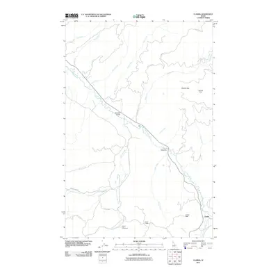
2011 Map of Clarkia
USGS Topo · Published 2011About this map
The Saint Maries River carves a deep valley through this portion of Shoshone County, serving as a primary corridor for both water and transport. In this 2011 topographic survey, the settlement of Clarkia sits at the southern reach of the quadrangle near the confluence of the river and the West Fork Saint Maries River. The landscape is defined by its drainage network, with numerous waterways like Hatton Creek, Olson Creek, and Childs Creek feeding into the main river valley from the surrounding high ground.
Find a feature on this map
34 named features on this map. Tap any name to fly to it.
Don’t see what you’re looking for? This feature index may not catch every label — zoom into the map to look around manually.
Map Details
Editions of this 2011 Clarkia Map
This is the sole edition of this map. No revisions or reprints were ever made.
Other maps of this area

1955 · Pullman
USGS Topo · 1:250,000

1955 · Spokane
USGS Topo · 1:250,000

1958 · Spokane
USGS Topo · 1:250,000

1958 · Pullman
USGS Topo · 1:250,000

1961 · Fernwood
USGS Topo · 1:62,500

1961 · Bovill
USGS Topo · 1:62,500

1969 · Anthony Peak
USGS Topo · 1:24,000
1969 · Merry Creek
USGS Topo · 1:24,000

1969 · Huckleberry Mtn
USGS Topo · 1:24,000

1981 · St Maries
USGS Topo · 1:100,000