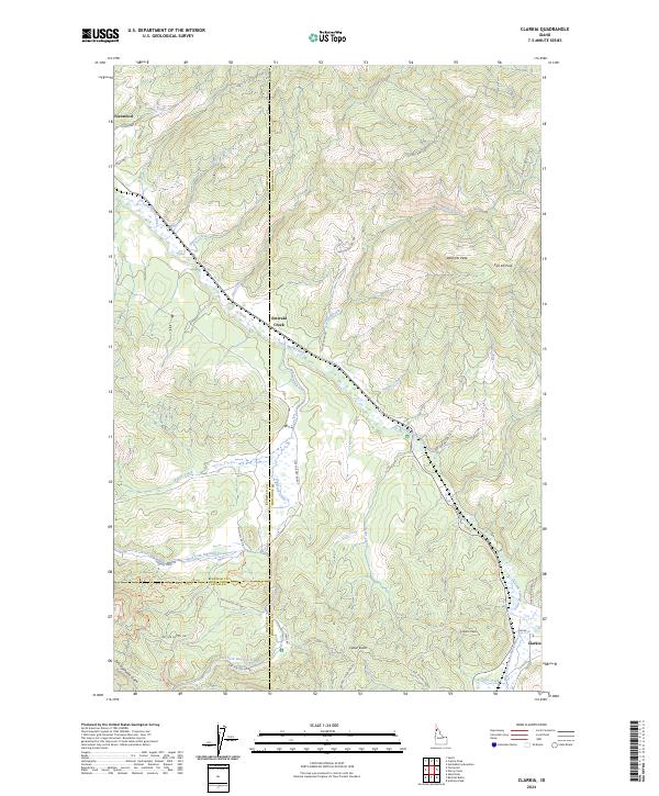
2024 Map of Clarkia
USGS Topo · Published 2024About this map
Saint Maries River carves through this northern Idaho landscape, where the borders of Benewah, Shoshone, and Latah counties meet. The settlement of Clarkia anchors the southeastern corner, serving as a gateway to high elevations like Clarkia Peak and Cedar Butte. To the northwest, the community of Fernwood sits near the confluence of Finn Creek and the river, while Emerald Creek marks a central point of intersection for the local drainage system. The map reveals an extensive network of forestry and recreational paths, including the Garnet Stone OHV Trl and Tailings OHV Trl, which suggest a history of resource extraction and modern land use. High peaks such as West Elk Peak and East Elk Peak overlook the deep valleys of Childs Creek and Staples Creek, illustrating the complex drainage patterns that define this timber-rich region.
Find a feature on this map
50 named features on this map. Tap any name to fly to it.
Don’t see what you’re looking for? This feature index may not catch every label — zoom into the map to look around manually.
Map Details
Editions of this 2024 Clarkia Map
This is the sole edition of this map. No revisions or reprints were ever made.
Other maps of this area

1955 · Pullman
USGS Topo · 1:250,000

1955 · Spokane
USGS Topo · 1:250,000

1958 · Spokane
USGS Topo · 1:250,000

1958 · Pullman
USGS Topo · 1:250,000

1961 · Fernwood
USGS Topo · 1:62,500

1961 · Bovill
USGS Topo · 1:62,500

1969 · Anthony Peak
USGS Topo · 1:24,000
1969 · Merry Creek
USGS Topo · 1:24,000

1969 · Huckleberry Mtn
USGS Topo · 1:24,000

1981 · St Maries
USGS Topo · 1:100,000