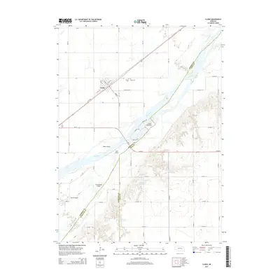
2014 Map of Clarks
USGS Topo · Published 2014About this map
The Platte River defines the landscape of this central Nebraska corridor, carving a braided path through Merrick and Polk counties. The settlement of Clarks is established on the northern bank, structured along a grid including W Amity St and Iller St. Local history and genealogy are preserved at Calvary Cem and Clarks Cem, both situated just northeast of the town center.
Find a feature on this map
55 named features on this map. Tap any name to fly to it.
Don’t see what you’re looking for? This feature index may not catch every label — zoom into the map to look around manually.
Map Details
Editions of this 2014 Clarks Map
This is the sole edition of this map. No revisions or reprints were ever made.
Other maps of this area

1896 · Stromsburg
USGS Topo · 1:125,000

1955 · Fremont
USGS Topo · 1:250,000

1957 · Fremont
USGS Topo · 1:250,000

1958 · Fremont
USGS Topo · 1:250,000

1958 · Fullerton
USGS Topo · 1:24,000

1958 · Silver Creek
USGS Topo · 1:24,000

1958 · Havens
USGS Topo · 1:24,000

1962 · Polk
USGS Topo · 1:24,000
1962 · Swedehome
USGS Topo · 1:24,000
1962 · Central City East
USGS Topo · 1:24,000