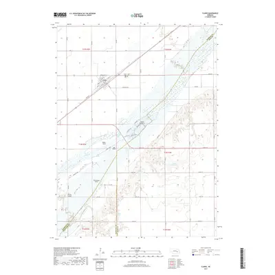
2017 Map of Clarks
USGS Topo · Published 2017About this map
The Platte River defines the landscape of Merrick, Polk, and Hamilton Counties, cutting a wide, multi-channeled path through this Nebraska agricultural region. The settlement of Clarks is the primary hub, situated north of the river along the historic corridor of the Union Pacific railroad. The town's grid is detailed with street names like Beardsley St and Amity St, while the local Po and neighboring Calvary Cem and Clarks Cem provide essential landmarks for genealogical research.
Find a feature on this map
67 named features on this map. Tap any name to fly to it.
Don’t see what you’re looking for? This feature index may not catch every label — zoom into the map to look around manually.
Map Details
Editions of this 2017 Clarks Map
This is the sole edition of this map. No revisions or reprints were ever made.
Other maps of this area

1896 · Stromsburg
USGS Topo · 1:125,000

1955 · Fremont
USGS Topo · 1:250,000

1957 · Fremont
USGS Topo · 1:250,000

1958 · Fremont
USGS Topo · 1:250,000

1958 · Fullerton
USGS Topo · 1:24,000

1958 · Silver Creek
USGS Topo · 1:24,000

1958 · Havens
USGS Topo · 1:24,000

1962 · Polk
USGS Topo · 1:24,000
1962 · Swedehome
USGS Topo · 1:24,000
1962 · Central City East
USGS Topo · 1:24,000