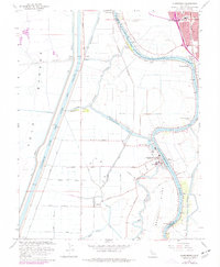
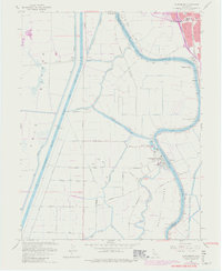
1967 Map of Clarksburg
USGS Topo · Published 1977About this map
The Sacramento River meanders sharply past Clarksburg and Freeport, defining a landscape of complex water management and river-bottom agriculture. The massive Sacramento Deep Water Ship Channel cuts a straight, industrial line through the western half of the map, contrasting with the natural loops of Babel Slough and Winchester Lake. On Merritt Island, a network of drainage canals and pump stations supports the fertile delta lands, while the Sacramento Northern line and an Old Railroad Grade trace the legacy of regional transport. Local infrastructure is represented by the Borges Clarksburg Airport and scattered energy sites, including several Gas Wells. The 1975 revisions, shown in purple, highlight the growth of the Sacramento corporate boundary as the city expands toward the river's edge, near the Pony Express Sch and regional shopping centers.
Find a feature on this map
44 named features on this map. Tap any name to fly to it.
Don’t see what you’re looking for? This feature index may not catch every label — zoom into the map to look around manually.
Map Details
Editions of this 1967 Clarksburg Map
5 editions found
Other maps of this area

1891 · Sacramento
USGS Topo · 1:125,000

1892 · Sacramento
USGS Topo · 1:125,000

1893 · Sacramento
USGS Topo · 1:125,000

1894 · Lodi
USGS Topo · 1:125,000

1902 · Fairoaks
USGS Topo · 1:62,500

1907 · Davisville
USGS Topo · 1:62,500

1908 · Courtland
USGS Topo · 1:62,500

1909 · Florin
USGS Topo · 1:31,680

1910 · Bruceville
USGS Topo · 1:31,680

1911 · Brighton
USGS Topo · 1:31,680