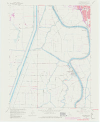
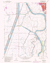
1967 Map of Clarksburg
USGS Topo · Published 1980About this map
Merritt Island and the surrounding delta lowlands define this landscape southwest of Sacramento. The town of Clarksburg stands as a focal point along the western bank of the Sacramento River, which snakes through the eastern half of the map past Freeport and Freeport Bend. This era shows a transition in land use and water management, evidenced by the massive Sacramento Ship Channel and the expansive Yolo Bypass to the west. Local infrastructure includes the Borges Clarksburg Airport and several Gas Wells dotting the agricultural grid. Remnants of older transport routes, such as the Old Railroad Grade, sit alongside complex irrigation and drainage features like Babel Slough, Winchester Lake, and Elk Slough, illustrating the intensive reclamation of the California Central Valley.
Find a feature on this map
50 named features on this map. Tap any name to fly to it.
Don’t see what you’re looking for? This feature index may not catch every label — zoom into the map to look around manually.
Map Details
Editions of this 1967 Clarksburg Map
5 editions found
Other maps of this area

1891 · Sacramento
USGS Topo · 1:125,000

1892 · Sacramento
USGS Topo · 1:125,000

1893 · Sacramento
USGS Topo · 1:125,000

1894 · Lodi
USGS Topo · 1:125,000

1902 · Fairoaks
USGS Topo · 1:62,500

1907 · Davisville
USGS Topo · 1:62,500

1908 · Courtland
USGS Topo · 1:62,500

1909 · Florin
USGS Topo · 1:31,680

1910 · Bruceville
USGS Topo · 1:31,680

1911 · Brighton
USGS Topo · 1:31,680