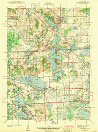
1943 Map of Clarkston
USGS Topo · Published 1943About this map
Clarkston and the surrounding townships of Springfield and Waterford appear in this early 1940s survey as a landscape defined by an intricate network of glacial lakes and the emerging infrastructure of mid-century Oakland County. The Grand Trunk Western railroad serves as a primary corridor, connecting settlements like Andersonville and Drayton Plains while passing near the Clarkston Sta Sch. The area is notably water-rich, featuring large bodies such as Pontiac Lake, Maceday Lake, and Lotus Lake, alongside the specialized Hatchery near Huntoon Lake.
Find a feature on this map
87 named features on this map. Tap any name to fly to it.
Don’t see what you’re looking for? This feature index may not catch every label — zoom into the map to look around manually.
Map Details
Editions of this 1943 Clarkston Map
2 editions found

Other maps of this area

1907 · Pontiac
USGS Topo · 1:62,500

1909 · Milford
USGS Topo · 1:62,500

1920 · Holly
USGS Topo · 1:62,500

1922 · Holly
USGS Topo · 1:62,500

1936 · Wixom
USGS Topo · 1:31,680

1936 · Highland
USGS Topo · 1:31,680

1936 · Clarkston
USGS Topo · 1:31,680

1936 · Walled Lake
USGS Topo · 1:31,680

1936 · Pontiac South
USGS Topo · 1:31,680

1936 · Pontiac North
USGS Topo · 1:31,680
Featured Places
- Waterford Township, MI
- Independence Charter Township, MI
- White Lake Charter Township, MI
- Springfield Charter Township, MI
- Clarkston, MI