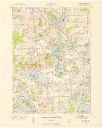
1952 Map of Clarkston
USGS Topo · Published 1954About this map
Deer Lake and the village of Clarkston anchor this mid-century survey of Oakland County, showing a landscape defined by an intricate network of glacial lakes and growing post-war residential footprints. The Grand Trunk railroad cuts diagonally through the terrain, serving Clarkston Station, Waterford Station, and the industrial sidings near Drayton Plains. The transition from rural agriculture to suburban development is evident in the cluster of institutions such as the Waterford High Sch and the Pontiac Municipal Airport.
Find a feature on this map
97 named features on this map. Tap any name to fly to it.
Don’t see what you’re looking for? This feature index may not catch every label — zoom into the map to look around manually.
Map Details
Editions of this 1952 Clarkston Map
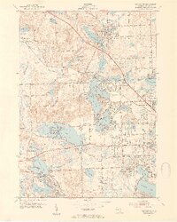
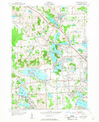
3 editions found
Other maps of this area

1907 · Pontiac
USGS Topo · 1:62,500

1909 · Milford
USGS Topo · 1:62,500

1920 · Holly
USGS Topo · 1:62,500

1922 · Holly
USGS Topo · 1:62,500

1936 · Wixom
USGS Topo · 1:31,680

1936 · Highland
USGS Topo · 1:31,680

1936 · Clarkston
USGS Topo · 1:31,680

1936 · Walled Lake
USGS Topo · 1:31,680

1936 · Pontiac South
USGS Topo · 1:31,680

1936 · Pontiac North
USGS Topo · 1:31,680
Featured Places
- Waterford Township, MI
- Independence Charter Township, MI
- White Lake Charter Township, MI
- Springfield Charter Township, MI
- Clarkston, MI