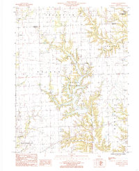
1984 Map of Clarksville
USGS Topo · Published 1985About this map
Mill Creek County Park dominates the central geography of this Clark County map, where the sprawling reservoir is fed by a network of waterways including Sevenmile Creek and Ennis Creek. The landscape transition from the flatter agricultural townships like Grandview and Symmes in the north to the more dissected drainage basins of the south reflects the region's glacial history. Tiny settlements like Clarksville and Doyles anchor the rural road grid, while the presence of a Pipeline and several marked Cem sites provide specific points of interest for local historians and surveyors. To the south, the terrain becomes increasingly complex as it drops toward Bluegrass Creek and the drainage of Martinsville, showing a territory defined more by its creek systems—such as Fox Creek and Big Creek—than by major urban centers.
Find a feature on this map
28 named features on this map. Tap any name to fly to it.
Don’t see what you’re looking for? This feature index may not catch every label — zoom into the map to look around manually.
Map Details
Editions of this 1984 Clarksville Map
This is the sole edition of this map. No revisions or reprints were ever made.
Other maps of this area

1932 · Marshall
USGS Topo · 1:62,500

1936 · Casey
USGS Topo · 1:48,000

1937 · Marshall
USGS Topo · 1:62,500

1942 · Casey
USGS Topo · 1:62,500

1943 · Casey
USGS Topo · 1:62,500

1946 · Kansas
USGS Topo · 1:62,500

1947 · Paris
USGS Topo · 1:62,500

1949 · Kansas
USGS Topo · 1:62,500

1949 · Paris
USGS Topo · 1:62,500

1953 · Indianapolis
USGS Topo · 1:250,000