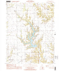
1998 Map of Clarksville
USGS Topo · Published 2002About this map
Mill Creek County Park dominates the center of this landscape, where the waters of Mill Creek are impounded to form a large branching reservoir. This system is fed by numerous named tributaries, including Sevenmile Creek, Ennis Creek, and Snakeden Branch, creating a complex network of shoreline and wooded peninsulas. The terrain is structured by the rectangular township and range system, reflected in the orderly road grid that connects small settlements like Clarksville and Doyles.
Find a feature on this map
27 named features on this map. Tap any name to fly to it.
Don’t see what you’re looking for? This feature index may not catch every label — zoom into the map to look around manually.
Map Details
Editions of this 1998 Clarksville Map
This is the sole edition of this map. No revisions or reprints were ever made.
Other maps of this area

1932 · Marshall
USGS Topo · 1:62,500

1936 · Casey
USGS Topo · 1:48,000

1937 · Marshall
USGS Topo · 1:62,500

1942 · Casey
USGS Topo · 1:62,500

1943 · Casey
USGS Topo · 1:62,500

1946 · Kansas
USGS Topo · 1:62,500

1947 · Paris
USGS Topo · 1:62,500

1949 · Kansas
USGS Topo · 1:62,500

1949 · Paris
USGS Topo · 1:62,500

1953 · Indianapolis
USGS Topo · 1:250,000