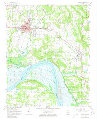
1962 Map of Clarksville
USGS Topo · Published 1981About this map
Clarksville serves as a regional hub on this 1962 survey, which documents the area just as the Arkansas River-Dardanelle Reservoir was being formed. The blue hatching across Cuba Bottom indicates land soon to be submerged by the rising reservoir waters at elevation 338. This shift from riverbank to reservoir shoreline redefined the local geography south of the Missouri Pacific railroad line. The map highlights the educational and social core of the town, featuring the College of the Ozarks and several local schools like Hurin Sch and Grace James Sch. Beyond the city limits, the landscape is defined by industrial activity, including numerous Strip Mines to the north and various Quarries and Shale Pits near Lamar, reflecting the extractive economy of the mid-20th century in Johnson County.
Find a feature on this map
49 named features on this map. Tap any name to fly to it.
Don’t see what you’re looking for? This feature index may not catch every label — zoom into the map to look around manually.
Map Details
Editions of this 1962 Clarksville Map
3 editions found
Other maps of this area

1887 · Magazine Mountain #1
USGS Topo · 1:62,500

1887 · Magazine Mountain
USGS Topo · 1:62,500

1888 · Dardanelle #2
USGS Topo · 1:62,500

1889 · Ozone
USGS Topo · 1:62,500

1890 · Magazine Mountain
USGS Topo · 1:125,000

1890 · Dardanelle
USGS Topo · 1:125,000

1906 · Batson
USGS Topo · 1:62,500

1934 · Ozone
USGS Topo · 1:62,500

1936 · Ozone
USGS Topo · 1:62,500

1956 · Russellville
USGS Topo · 1:250,000