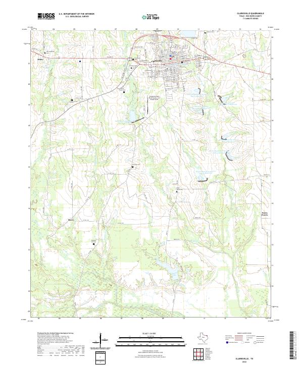
2022 Map of Clarksville
USGS Topo · Published 2022About this map
The Red River County Courthouse stands as the central landmark of Clarksville, surrounded by a detailed street grid including Depot St and E Broadway St. This portion of Red River County is characterized by a high density of rural burial grounds, serving as a significant resource for genealogical research. Prominent sites include Clarksville Cem, Fairview Cem, and Saint Joseph Cem within the town limits, while outlying locations like Aiken Grove Cem and Harris Chapel Cem trace the earlier settlement patterns of the surrounding countryside.
Find a feature on this map
104 named features on this map. Tap any name to fly to it.
Don’t see what you’re looking for? This feature index may not catch every label — zoom into the map to look around manually.
Map Details
Editions of this 2022 Clarksville Map
This is the sole edition of this map. No revisions or reprints were ever made.
Other maps of this area

1950 · White Rock
USGS Topo · 1:24,000

1950 · Annona
USGS Topo · 1:24,000

1951 · Annona
USGS Topo · 1:24,000

1951 · White Rock
USGS Topo · 1:24,000

1953 · Texarkana
USGS Topo · 1:250,000

1956 · Texarkana
USGS Topo · 1:250,000

1964 · Bagwell
USGS Topo · 1:24,000

1964 · Cuthand
USGS Topo · 1:24,000

1964 · Bogata
USGS Topo · 1:24,000
1964 · Dimple
USGS Topo · 1:24,000