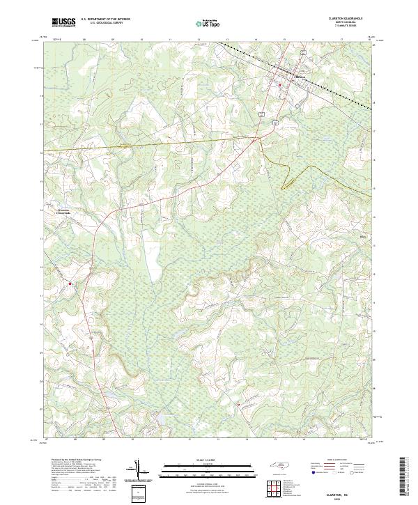
2022 Map of Clarkton
USGS Topo · Published 2022About this map
Clarkton sits at the intersection of rail-aligned streets and rural thoroughfares, anchoring a landscape defined by the extensive wetlands of the Coastal Plain. The town's grid, featuring W North Railroad St and S College St, transitions into a dense network of swampy drainages and bays. To the east and south, the low-lying terrain is dominated by Brown Marsh Swamp, Slades Swamp, and the expansive White Marsh.
Find a feature on this map
85 named features on this map. Tap any name to fly to it.
Don’t see what you’re looking for? This feature index may not catch every label — zoom into the map to look around manually.
Map Details
Editions of this 2022 Clarkton Map
This is the sole edition of this map. No revisions or reprints were ever made.
Other maps of this area

1953 · Chadbourn
USGS Topo · 1:62,500

1953 · Florence
USGS Topo · 1:250,000

1954 · Florence
USGS Topo · 1:250,000

1955 · Whiteville
USGS Topo · 1:62,500

1955 · Elizabethtown
USGS Topo · 1:62,500

1957 · Bladenboro
USGS Topo · 1:62,500

1982 · Elizabethtown
USGS Topo · 1:100,000

1986 · Whiteville
USGS Topo · 1:100,000
1986 · Chadbourn
USGS Topo · 1:24,000
1986 · Bladenboro
USGS Topo · 1:24,000